Drone Roof Inspection & Thermal Imaging in Boise, ID
Seeing the Whole Roof Without Walking It
A big low-slope roof hides its problems from anyone standing on it. By the time you can feel a soft spot underfoot or see a stain bleed through the ceiling tile below, water has usually been moving through the assembly for months. We fly commercial roofs across Boise with high-resolution and thermal cameras precisely so we can find that trouble before a boot ever touches the membrane, and before a small wet area turns into a saturated section that has to be cut out and replaced.
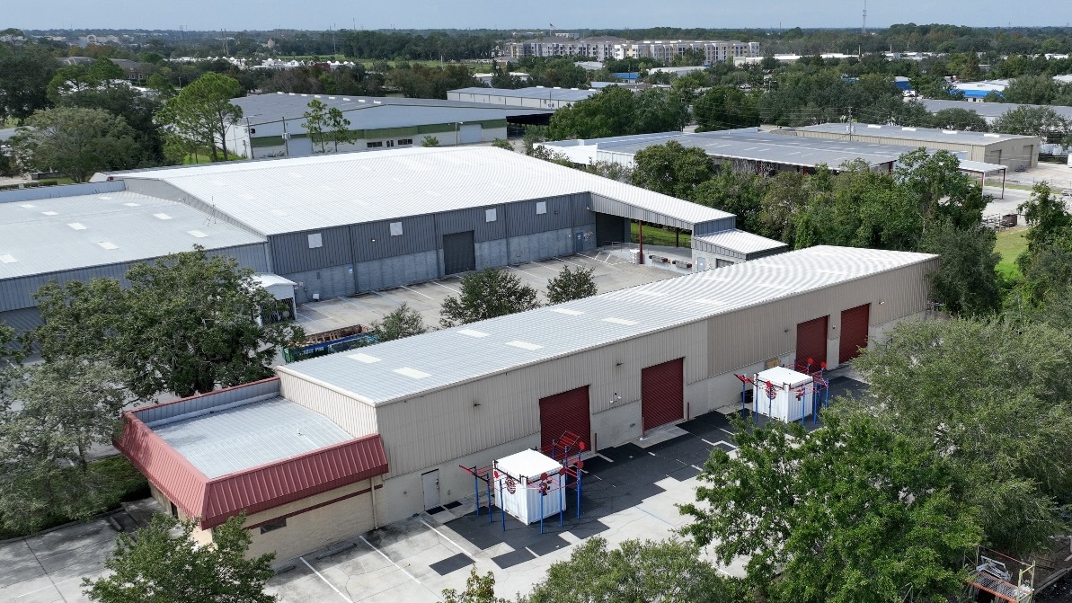
This matters most on the buildings that dominate the Treasure Valley's commercial inventory: the distribution and warehouse decks near the airport off Gowen Road, the tilt-up and big-box roofs along the Franklin and Overland corridors, the campus rooftops out toward Meridian, and the older industrial stock in Garden City. These are acres of flat membrane where a foot inspection takes most of a day, leaves traffic damage of its own, and still misses the ponding areas and seam failures that aren't visible from standing height. A systematic aerial pass covers all of it at a consistent altitude in a fraction of the time.
Thermal Imaging Finds the Moisture You Can't See
The single most valuable thing a drone brings to a roof inspection in Boise is the infrared camera. Wet insulation holds the day's heat longer than the dry board around it. After sundown, when the roof releases that stored heat, saturated areas glow warmer in thermal imagery while dry areas cool off. Flown during that cool-down window, the thermal pass draws a moisture map of the assembly that no visual walkover can produce, even where the membrane surface looks perfectly intact from above.
That map is not a curiosity. It is the data that decides your scope. If moisture is confined to a few discrete areas, you are looking at targeted cut-and-patch repairs and a recover. If the thermal scan shows wet insulation spread across a large share of the deck, recovering over it would just seal the water in, and a full tear-off is the honest answer. We would rather show you the infrared evidence and let the assembly tell you which path it needs than guess from a few core cuts.
- We fly thermal passes during the post-sunset cool-down, when the contrast between wet and dry insulation is strongest.
- We confirm suspect areas with verification cores so the moisture map is grounded in physical evidence, not infrared alone.
- We deliver the findings as a marked plan you can hand straight to your facilities team or a roofing consultant.
FAA Compliance and Safe Operations
Flying a drone over a commercial building is regulated airspace work, not a hobby. Our operations run under FAA Part 107, with a certificated remote pilot in command on every flight. Boise carries a real layer of complexity here: much of the prime industrial roof stock sits near the Boise Airport, which puts large stretches of the Gowen Road and south-of-downtown corridors inside controlled airspace. We secure LAANC authorization for those flights, hold altitude and line-of-sight limits, and brief the site before we ever lift off.
The safety upside is the whole point. We keep crews off of unknown-condition roofs, off ladders and parapets, and away from skylights and brittle deck areas during the assessment. On occupied buildings, we keep the inspection over the roofline and out of your tenants' way. The roof gets documented thoroughly without anyone taking on fall exposure to get the data.
Documentation Built for Claims and Capital Planning
Every flight produces a record you can act on. We tag imagery with GPS location so a defect on the report can be found again on the roof without a treasure hunt. After a hailstorm or a spring windstorm, that record becomes claim evidence: impact density, displaced or lifted membrane, damaged rooftop units and flashings, all photographed and located in a format commercial adjusters can review remotely. For contested losses, an organized aerial package carries far more weight than a handful of ground photos.
The same imagery feeds long-range planning. When you are budgeting roof replacements across a portfolio, a thermal-and-visual baseline on each building tells you which roofs are failing now and which have years of life left, so capital goes where the water actually is. And before any reroofing proposal, an aerial survey verifies roof area, locates every curb and penetration, and documents existing conditions, which cuts down the change orders and field surprises that come from bidding off assumptions.
- A GPS-tagged photo set covering the full roof surface, drains, seams, penetrations, and rooftop equipment.
- A thermal moisture map identifying suspected wet insulation, with verification core locations noted.
- A condition summary written for the audience that needs it, whether that is an adjuster, an owner, or a design team.
Building a Routine Inspection Cadence
Drone inspection is most powerful when it is not a one-time scramble after a leak. We recommend two aerial passes a year on the larger Boise roofs, timed to the weather that actually stresses them. A late-spring flight catches the damage left behind by winter freeze-thaw and the windstorm season, which is when lifted edge metal, split seams, and clogged drains tend to show up. A fall flight, run with the thermal camera during the cool-down, finds moisture that worked its way in over the summer before it freezes inside the assembly and expands the failure over winter. On a portfolio, a consistent cadence builds a year-over-year record that shows which roofs are deteriorating and how fast, instead of a stack of disconnected snapshots.
That history pays off at claim time, too. When a hailstorm rolls through the Treasure Valley, an adjuster's first question is whether the damage is new or pre-existing. A recent baseline flight on file answers it directly, which keeps legitimate claims from getting denied as old wear and keeps you from chasing repairs the policy should cover. It also keeps your maintenance dollars honest, because the trend line tells you when a roof has crossed from patch-and-maintain into plan-for-replacement.
When a Drone Is the Right Call in Boise
Aerial inspection earns its keep on large flat commercial roofs: warehouses, distribution centers, retail centers, office and school campuses, and multi-building sites where a foot inspection is slow, incomplete, and hard on the membrane. On a small or steep roof, a hands-on inspection is often faster and just as thorough, and we will tell you when that is the better tool. For most commercial roofs over roughly ten thousand square feet here, the drone gives you a more complete and lower-risk picture.
If you manage commercial property anywhere from downtown Boise out through Meridian and Garden City and you need a roof assessed, a storm loss documented, or a baseline before you reroof, get in touch. We will schedule the flight, handle the airspace authorization, and turn the data into something you can budget and build from.
Leak points, drainage, seams, penetrations, edge metal, roof access, and interior risk should be clear before the next roof decision is priced.
Immediate repair, maintenance, coating, recover, and replacement choices should be measured against roof age, moisture risk, tenant disruption, and budget timing.
A site visit is useful when the owner needs a documented roof condition, active leak response, storm review, or a clearer capital plan.